
Pre-Spiel
Back to where it all started – my first expedition race was XPD 2015 – so the opportunity to race a 500km+ XPD again is pretty tempting when there’s a good team and location (within the state) on offer!
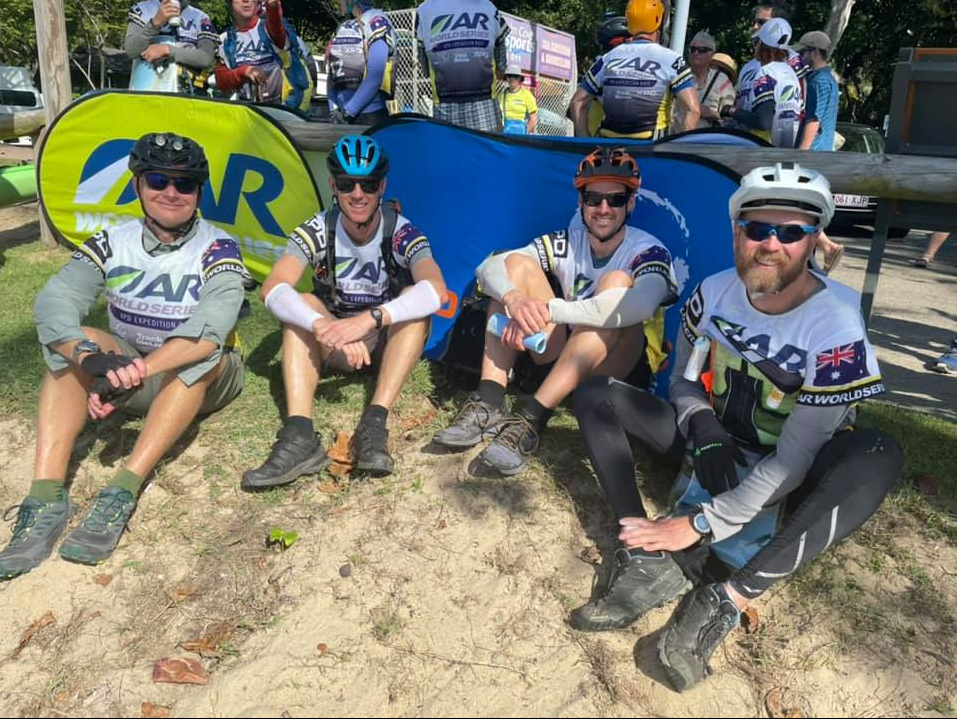
With Adam (2019 Alpine Quest teammate) again on task by the organisers to haul his supply of green CTR kayaks to the race, he called us in to make his Cairns trip more (memorable, painful?) than just delivering kayaks. The rest of the team comprised weekly running buddy Bevan, and Adam’s mate Paul.
There were a few pre-race attempts at training; one overnight bike & hike, a plan for weekly paddling (started and stopped at one really frigid winter paddle – enough!) and a few other bits and pieces. Ultimately poor Adam had a few issues with a knee surgery to recover from and then some kind of foot carpet tunnel. It seemed as long as we kept him alive and nothing detrimental went wrong, we should be okay.
Just 3 weeks out from starting: a week long COVID lockdown, lifted with 2 weeks to the day until the start it looked possible! Crickets from the organisers meant they were clearly running with it for now.
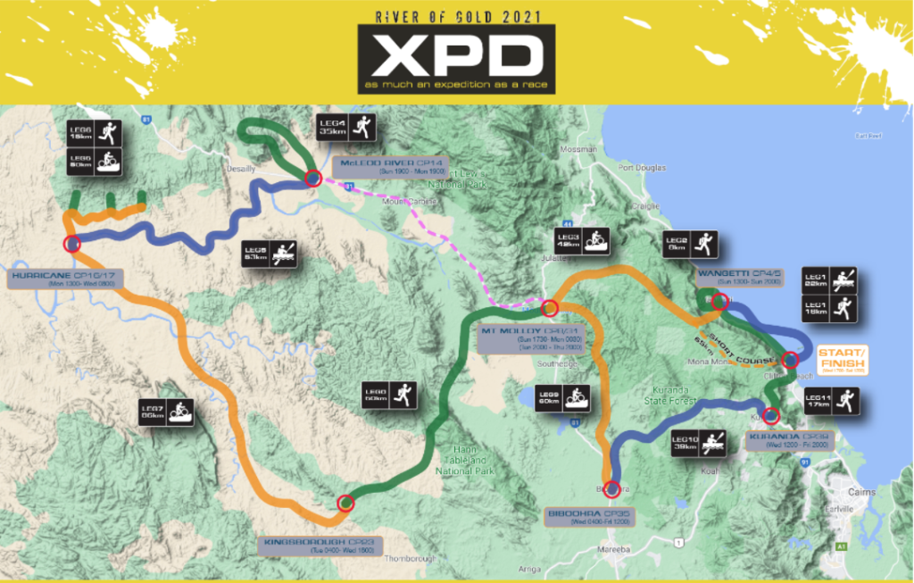
The course logistics released with 1 week to go had a staggering 11 legs and none of them particularly long which meant mixing it up often (to be honest I can be happy with either a 6 leg Patagonia or this 11 leg XPD).
Also the preview usually says the elevation of each leg – with no indication it must be a relatively flat course! (Somewhat true..).
The race to the start line had its usual hiccups;
… Adam’s huge kayak trailer had it’s wheel fall off on the way up just days prior to the start..
… I few into Cairns with my family, transited to the race start town Palm Cove, and there in instant paradise I just wanted to sit on the palm tree lined beach and ditch the race altogether.. That sort of thing !
Our simple goal: finish the whole course as a team and fully ranked.
The Race
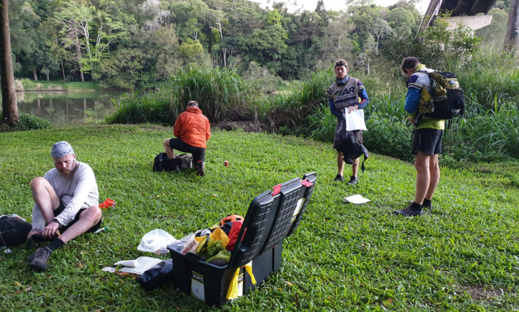
In ‘unseasonably hot’ weather (heading well into the 30deg’s) we started putting our things together into the transition boxes, and having done a big shop we had a smorgasbord food from Snickers bars to some $90 worth of biltong! Eating like kings this race.
A nice breezy competency, then a ‘welcome to country’ (welcome to race) on the beach, an offer to come back to HQ for dinner which was a nice surprise, and then it was off for a good night’s sleep ready for race day!


Lockdown – HQ, Palm Cove
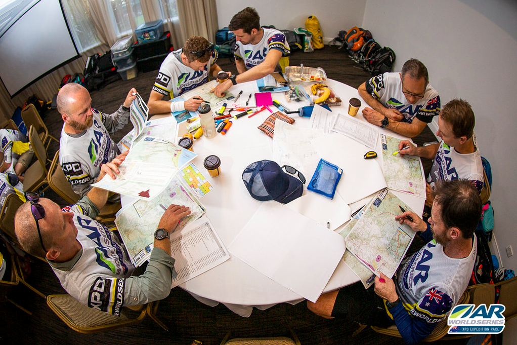
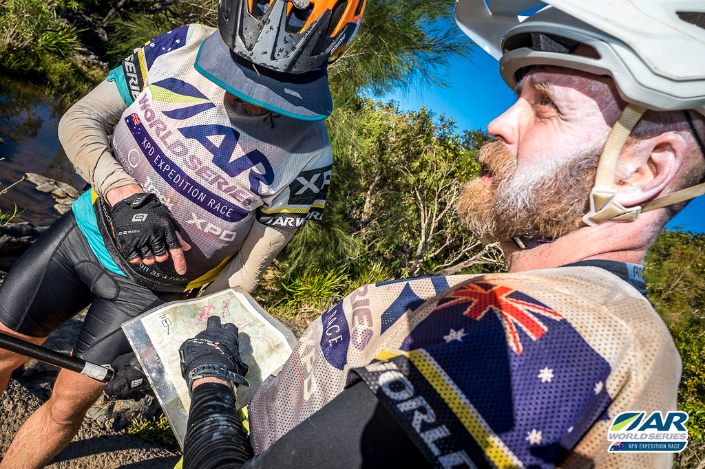
First thing 7:30am, we received a bunch of maps, some without any checkpoint CP markings which suggested there could be some human error coming our way, and we also listened carefully to Race Director Craig’s chat, including him mentioning we’d be meandering along the Bicentennial National Trail (BNT) which turned out to be important.
We raced through map marking/planning splitting into pairs but still ran out of time to mark all the maps up.. So be it! Time to move onto the beach for the start gun..
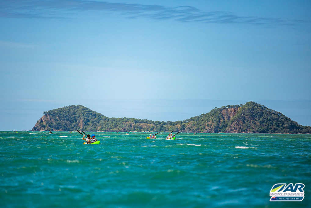
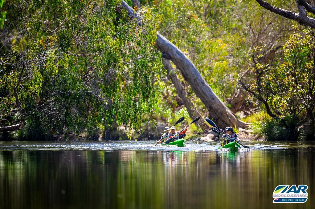
Leg 1 – Split Kayak/Trek – 22km Kayak/16km Trek
This leg had half of each team as a pair in the CTR boats for an ocean paddle around an island, whilst it was a coasteering trek for the other 2. Fortunately with little discussion we happy settled with an Adam/Paul paddle combo and me/Bevan trek combo.


With our own pace in mind, we gently darted off from the start, those of us on the beach jogging along looking back at some of the carnage as the boats headed into the wind and chop! Highlights also for the beachgoing racers was the passing through a nudist beach – all male – and strange husband and wife (?) pair with a kid having professional photo’s taken in their matching ladies tiger swimsuit and full makeup.
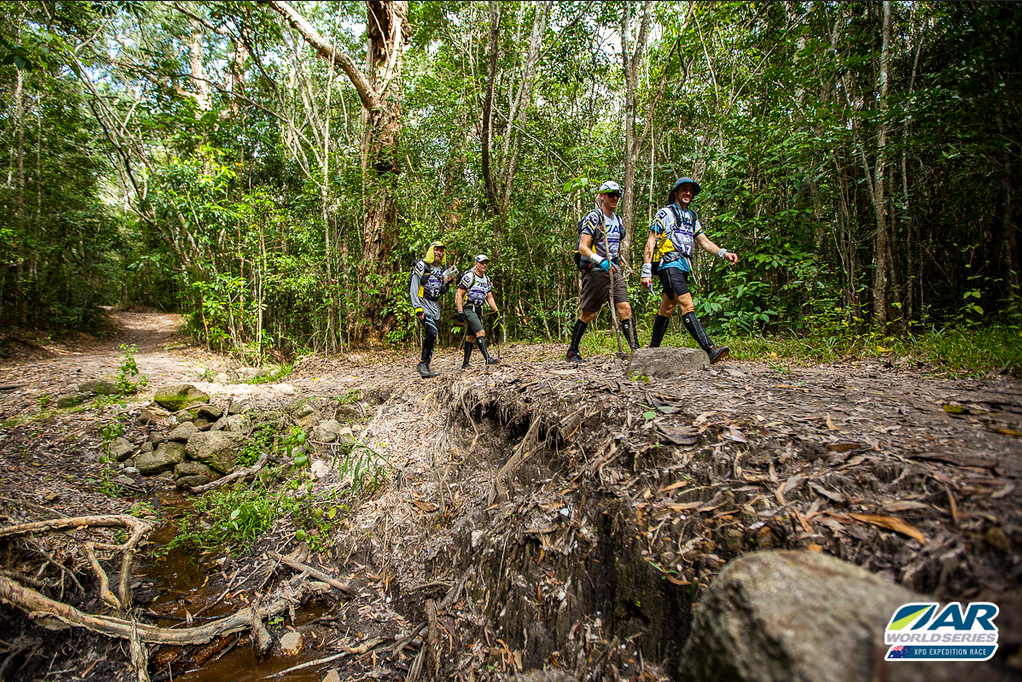
For us coasteering along the beach, it was quite a lot of rock hopping and not quite the cruisy beach walk we expected – including thinking we would arrive way before the boat, when in fact we could see some familiar specks getting out of a boat on the beach as we neared sight of the first transition TA1 and realised it was Adam and Paul! Whoops! Run!


Leg 2 – Trek – 8km
Back together as a team, we setup bikes for the next leg 3, and then we trekked down the road before our turn off darting down a track. Just before heading down the track, jogging back the other way just 500m from the TA was Rob Preston’s Explore Gippsland team – in shock I thought the poor guys had forgotten something! Then it clicked they were waaay in front, with probably 2 hours on us after just 1 leg!
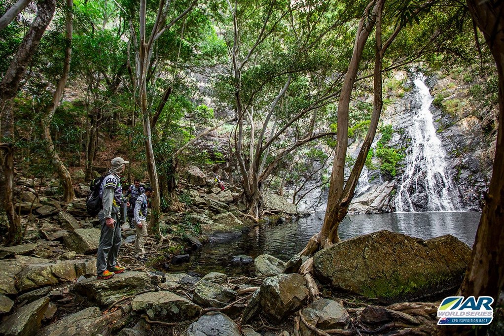
This trek was navigation friendly and we just bounced along an established track into Flat Rock swimming hole (quick head dip into the water) and then onto Hartleys Creek Falls. A nice falls but no time to wait around, and as an out-n-back we could switch off a little and just chat our way back out to the TA.
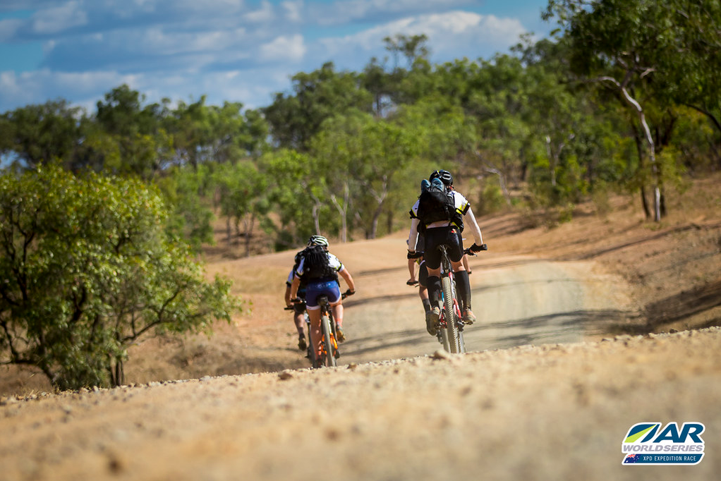
Leg 3 – MTB – 42km
We jumped on the bikes all loaded and topped up with water, and at the shoulder of the day we noticed it was considerably more pleasant riding – the heat it seemed come on at 9:30am and leave about this time which was 4pm+. Winding up past Hartley’s Crock Farm was a (long) proper bitumen road that took us up the Macalister Range. What was interesting was this road had a gate at each end and so it was a nice road surface up, all to ourselves.
Reaching the top there was a checkpoint on a junction that we struggled with for about 10-15mins; with 2 junctions next to each other it was far more of a struggle than necessary. Anyway! We moved on as the sun was setting, down a dirt fire road that rolled up and down around the base of a mountain and eventually onto bitumen into Mt Molloy where TA3 was.
We were aware the next trekking leg required a bus and the roadbook had fixed departure times – we arrived into the TA to see the 8pm bus rolling down the road so we knew we had until 9:30pm for the next one which meant we could have a little break.
Leg 4 – Trek – 35km + Ropes
Sort-of break.. Not even enough time to visit the Mt Molloy pub! We had to get our names onto the restricted number bus list, and that required our bikes and boxes handed in first. So we had a flurry to get bikes in the boxes and make sure we had the things we needed,etc. With some hot water at this TA we indulged in a freeze dried meal, and just drinking the hot water, which kept us busy and warm until the bus departure.
The bus ride took us some 45mins down the road, and then we were left to our devices to start what turned out to be a very long and challenging trek. We’d picked an established track to start off with before cutting off the path to head towards our first CP. Adam and Bevan did a great job of navigating us and in attempting the next checkpoint across a very steep range of mountains, that the contour intervals on the map meant on the ground we were faced with a series of knolls in between the bigger peaks that were the only thing shown on the map. With some confusion still abound while we worked this out, we made the checkpoint and eventually into a gorge where we spent a bit more time looking for another CP (classic AR ‘haven’t gone far enough’!).
As day broke we were out of the gorge and down a dirt road which wound down for a while to lead us to the ‘ropes’ section of the race. Collecting a harness and helmet we marched a little bit back to a tagged route that took us to the top of a dry waterfall where abseiling ropes had been set up.
At the top we (video here) had thoughts about how cold the water would be, however it turned out to be fairly pleasant and was a good wash after a sweaty day and night prior – that now sweaty tainted water was also perfect for refilling our water bladders!
Whilst cloudy early and we had that delightful pre-9am time, those clouds left shortly after and the walk out was brutal. The sun was in full stinging force along with it’s comrade, humidity. The walk out was no short walk either – it took some 3-4 hours through undulating open terrain via a few CPs and then onto the main road in the area.
With little shade it hurt! By time we were on the road we were all out of water too and so we just had to head down trudge on to the TA, arriving somewhere around 2pm.
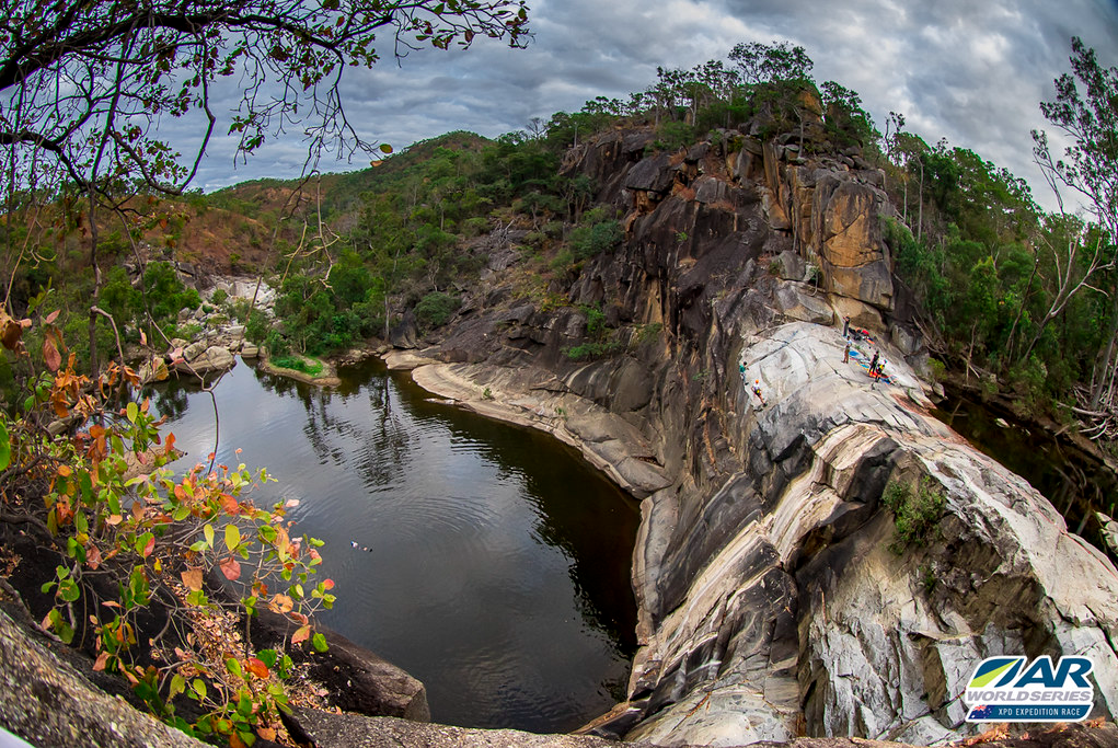
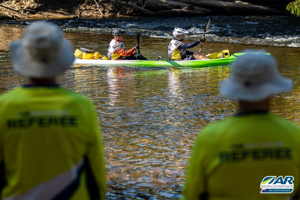
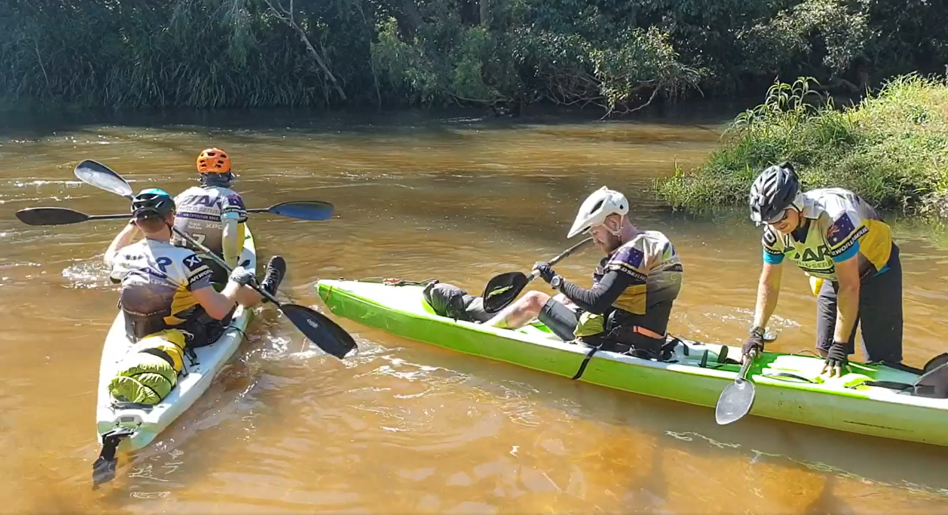
Leg 5 – Kayak – 53km
After drinking gallons of water, a coke, an up and go, and whatever else we could lay hands on in our boxes, we were ready to transition.
The volunteers mentioned waiting for helmets to arrive and we didn’t know why they were required and so we wanted to keep moving, but to be honest they were actually really valuable later on, or shortly on even.
Finally pushing our CTRs down to the creek it was slow going on the water as we were in a side river that fed into the Mitchell River, which was our route proper. This side river was an amalgamation of every huge tree a storm had pushed over or down the river, and it was slow going slipping and sliding dragging boats over logs and hitting heads on low branches,etc!. We were actually concerned at our slow pace vs. the road book overall time and we really wanted to hit the Mitchell before dark. Well we did, just. At that point I tossed the map to Adam, admitting that in the dark my kayak navigation would be horrible, and luckily he obliged to take over (and did a good job!).

We stopped on dusk for a quick snack, got in warmer gear and made jokes at each others expense about a freshwater crocs coming up behind on the bank!
The paddle was fairly interesting for a night paddle, helped by the fact it was flowing well, and it included crossing a road causeway at pace and hearing a delightful scrape along the bottom of the boat (sorry to the CTR owner!). At some point we got tired and had a cold-nap. These cold naps proved to be amazing for our race – stop on the spot and fall asleep as you are; eventually you cool down after a while ~20mins, and snap back awake shivering, forcing you to continue on!
As this Mitchell River section had quite a few mini-rapids, eventually we had enough of negotiating rocks and path options in the dark and taking the wrong lines, getting stuck, getting cold and wet/dunked, and so we decided to pull up stumps for a real sleep. I slept wrapped in our bothy bag which was just a modified version of the cold nap and I woke up really cold and rolled around for quite some time before we all got up in the early light to push on.
After maybe an hour max we came down a stream with a fence of barbed wire across it at head height! In the dark it could have been really dangerous. Also a little bit further on were the graded rapids (3?) they warned us about complete with big XPD signage so you didn’t go flying past:
Adam and Paul continued and shot down the rapids bobbing like an out of control cork in huge flow, off the many drops. Not for the faint hearted! Before they disappeared out of our view, completely out of control in the torrent of water, we saw the boat tip over as Adam in the front was cleaned up by a low branch off the bank that, for sure, I thought had taken his head off.
Bevan (as awesome kayak buddy for the race), and I talked – yes we wanted to say we did the rapid, yes we’re in a race and you do these silly things, yes it kind of looked cool in a terrifying way, yes we felt it was the ‘man’ thing to do… But boy the other guys made it look like an invitation for death! We saw an opportunity that was a nice blend of heroic rapid padding and the chicken option: There was a drop to the side into a small pool, from there we could launch off a ledge and skip the decapitating branch and still do most of the rapid. It was on! We loved it!! We even stayed in the boat, which was some miracle.
The fun eased and some time shortly after in the mid morning, we arrived at the TA.
Leg 6 – MTB & Trek – 50km MTB/15km Trek
Without much drama (and after another much needed coke) we swapped onto the MTB and headed out for a combination MTB & trek leg. Surprisingly this took all day and yet again we were in the baking heat.
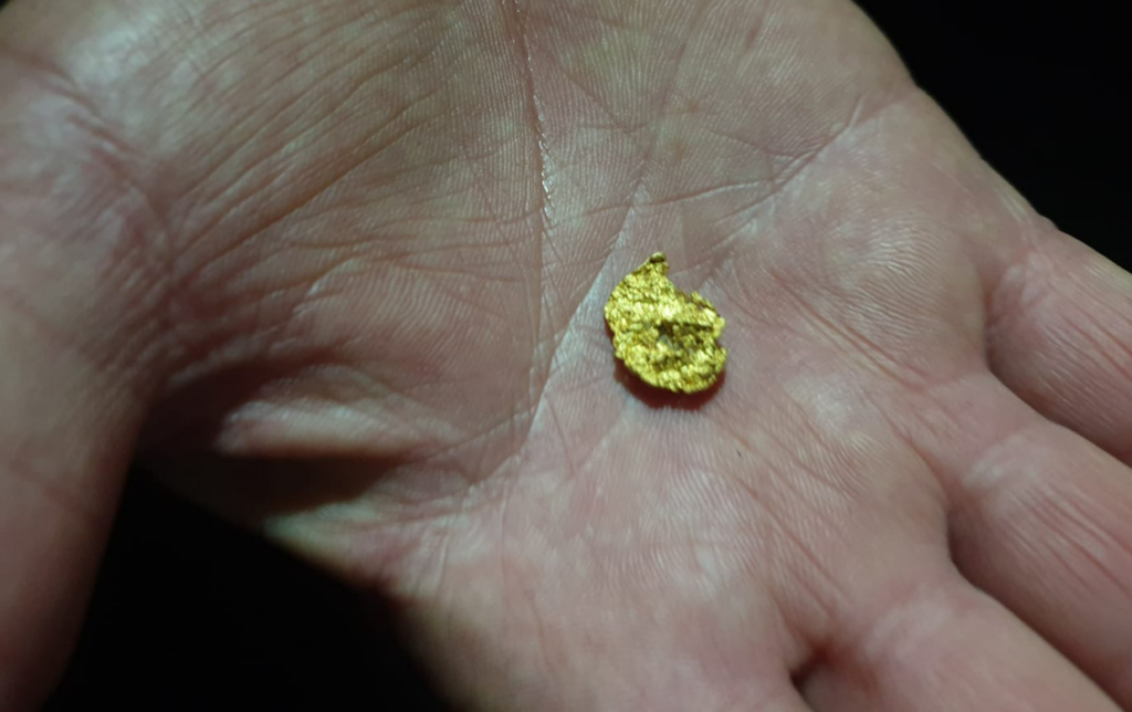
We were tasked with biking to a drop point CP, leaving the bikes there, trekking on foot to another CP and back, then hopping back on the bike and riding to the next CP, drop the bike and trek, and so on. The interesting feature of this leg was collecting a bag of dirt at each foot CP, which we were to use later to pan for gold – yeah right there’s any gold in them.
Through the grapevine we’d heard the maps “contour-interval-small-hills-not-shown” issue we’d had earlier on the first trek was causing havoc for other team so we wanted to get as much done as possible. Luckily with 2 down, the trickiest one we marched up at sunset (for a stunning view and glow off the escarpment walls of Mt Mulligan in the distance) and got back down in time to put the lights on the bikes. Wew!
The following two further CPs went fairly well, just requiring a decent amount of walking (luckily I had decided to wear my trekking shoes despite the SPDs), and in the late evening we were soon biking back to the TA we started from.
Leg 7 – MTB – 86km
We had a compulsory time stop at this one to account for the requirement to pan for gold. We hardly took this serious but then by some stroke of luck Paul pulled out an (the) absolute whopper! Adam and I instantly decided we needed to pan too, until we were basically done and Michelle the volunteer said only 1 sack had gold anyway! Good one, but we were happy for Paul as there was only one “big” nugget for teams to find. We joked that he could take us all out for a really fancy meal after the race (*before cashing the gold in to find out it is probably worth $50).
Onto the bikes we were in the dead of night and I was happy to have a break from the bike nav, but gees it makes you tired, just tagging along and not concentrating. It was fairly uneventful bumping along tracks overnight, we had a cold nap somewhere along the way, and when the sun was just about to come up we had a real struggle – in fact not just us, as it seems in post-mortem all teams had trouble finding this one checkpoint that spat you out onto the main dirt road. Luckily after our back-forth the sun had come up enough and we pushed through to find it, and thankfully were on a road towards this little settlement.
On the map it looked like a settlement complete with airstrip – we made jokes about checking into the hotel, stopping at the Maccas for breakfast.. The reality was this place wasn’t actually a place. It had a couple of abandoned houses and a few other structures that by no means constituted a town!
Onwards we peddled on the dirt road up and down small and intermediate hills, the day heating up as we progressed. Eventually the full escarpment of Mt Mulligan was above us and it was an impressive sight! Quite a nice distraction as the heat intensified and we arrived at the abandoned town of Mt Mulligan (which has an interesting history). Under a baking midday sun we collected the CP then quickly ducked to a nearby tree for some shaded relief. The ghost town feel was quite unique – deserted of people of course – but with formed streets, remnants of buildings and plaques abound listing what had stood in various spots. Something about stopping to explore the area nagged at me to come back and visit some day.


We pushed on from the town but just a kilometre or two later the road hit a flowing feeder creek into the Hodgkinson River and it was just too tempting.. We were stopping again so soon but this was like an oasis to bathe in fresh water. Delightfully worth it!
Trudging along the dusty road in the heat our next target was a CP at a cemetery which was also the turn off towards our TA. Some travellers stopped there were offering water to thirsty looking racers, which was kind. They through it was unbearably hot parked under a tree despite having an airconditioned ute to sit in all day – oh such luxury!
Whilst the TA seemed close, the final pedal dragged on but we made it, desperately thirsty as has been the theme.
Leg 8 – Trek – 60km
After a little nap to pass the heat of the day, we gathered together just before sunset and headed off – little did we know this would end up to be a monster 26hr leg.
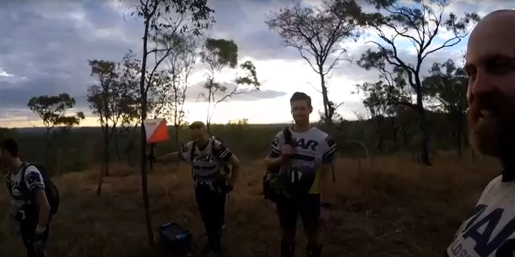
The first checkpoint was at an abandoned mine shaft which is the sort of thing that makes me love Adventure Racing, then we wound down and back up a hill crisscrossing the BNT before we had to make a call where to go off piste and find one of the more challenging checkpoints.
Late at night we really had to concentrate on the map, trusting the bends in dry river beds and heavily relying on the strange accuracy of Paul’s step counting measurements. Thankfully we got the checkpoint, then scrambled our way down an escarpment and through more riverbeds to find a fire trail to take us onward.
Following this trail took a few turns before we located ourselves in place for the next CP up from a creek which sounds simple – but we really struggled.. Thankfully it seems we weren’t the only ones, and with the help of one of the youth teams that we had yoyo’d with a lot during the race, we found it and were able to continue.
The next bit turned out was actually following this BNT marked track as foreshadowed by Craig the RD, and I drifted to the back of our conga line to do some sleep walking, struggling in the midnight hours.
When the sun was starting to light the sky we navigated around this Hann Tableland section which, like all of the BNT was fairly average in the BNT markings – (…whilst maybe better for visibility I clearly think backwards to the intention of trail markers; in that they’re always on a distant tree off to the side of a trail and pointing say 45deg for a turn, instead of on a tree in front of you at the turn and pointing horizontally parallel to the track direction..) – and with the intermittent markers, early morning sleepiness we missed a turn and followed what was probably a farmers access track. Adam whipped us into shape, and whilst about an hour deviation we were back in the right direction.
Very low on water reserves we found a small puddle at the bottom of the hill, but a dead toad upside down in it was just a bit much and we thought we could find better.. Sadly the next puddle was some while away. Now down off the mountain, in the baking heat of the day, we walked across barren open land until some form of “oasis” appeared in the form of the Little Mitchell River. Shaded trees would be our spot to nap for a little while, but sadly the little water it had was horribly stagnant and full of cow poo. I just couldn’t fill up in it.. This was going to be a very hot 26hr long stage on about 3.5L of water!!
We had one final mountain to conquer on this leg and for a blip on the map it took some 4+ hours to drive up its nose and do a lot of slow scrambling across the top. By the time we reached the CP on the far end, we were of course 100% out of water, and it was a fast slide down the steep backside of the mountain as the sun set.
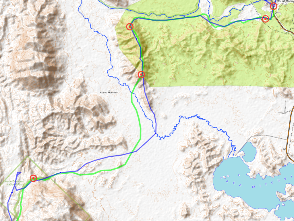
Following was a very long 10km/2+ hour (boring) bitumen road march back to base at the TA of Mt Molloy.
Leg 9 – MTB – 60km
We set off on bikes down the road just before midnight, and again I was struggling at the back of the pack, so very tired.. Thankfully the guys agreed to a cold-nap to just get my head back in the game and after that I felt great and actually picked up the map to navigate down what was called the “Blue Dot Trail” through the Kuranda National Park. (I think we probably saw maybe 2? blue markings to guide us across this whole ~20km and long 5+ hour trail).
It was proper single track – in fact it was actually a hairy walking track, not for bikes at all – and I was impressed with our team effort and bothered-ness to actually ride back up the side of some of the tough and rough ups after the dips. There was very little walking which helped our pace and we made the best of the varied mud, jungle, and forest,etc. Understandably though, with the lack of blue dots the guys also had doubts on the trail when I estimated it at 14km.. We passed 14km and I re-measured at roughly 16km.. We passed that. With the twisting, undulations,etc. it actually was more 21kms and thankfully we popped out where we should have onto a road at the next CP!
As day broke at the CP, we turned around to wake Paul up from where he’d collapsed on the road itself, and continued on across this horrible range of hike a bike which was then a repeat of flying down again to the base of the next climb. It was made a little fun by being some sort of ‘battle’ neck and neck with Dash, the other all-male team. (The battle was for fun though, as they had told us earlier they dropped a CP which gives them a 10hr penalty. We hadn’t dropped a CP, so in theory we were 10hrs ahead come the finish line).
After a confusing exit to find a checkpoint that stopped the clock, we had a slow roll to the town which was the host of the next kayak leg. The clock stop intention was to give us ample time to ride slowly on the busy highway – we made it to town with time for a pie and a couple of treats at the local servo.
Leg 10 – Kayak – 39km
Second last leg and the end was in sight! But also stressful.. The time was nearing midday and the estimate for this Barron River paddle leg was 5.5 to 10 hours – there was a dark zone to stop padding on the river at 6pm and we were not a ‘fast time 5.5hrs’ team. However! We were told the flow was great and 5-something hours could be achievable.. Go go go!
We took off and were really happy with the flow and progress. However at one point Adam said he better look at the map as we had all been just enjoying the ride – crikey have we missed a CP! No way!! Fortunately he picked up the map within a kilometre of reaching the CP and we managed to get them all on the way down.
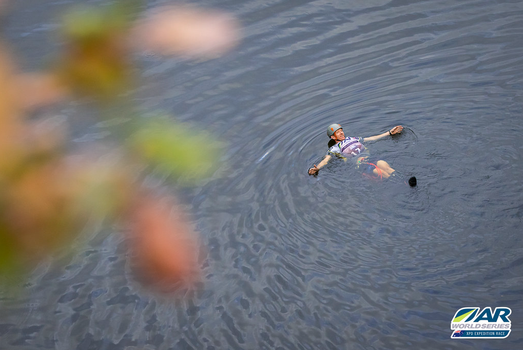
There were a lot of rapids on this paddle, Bevan and I were endlessly floundering in the water, smashing shins on submerged rocks and trying not to lose the boat taking off without us.
At one point there was a another huge graded (2/3?) rapid which the safety officer for the race, Jarred, was standing to watch/help teams come through. Hilariously Bevan and I launched off the big sucker edge which made a most remarkable paddle effort ever. Jarred captured it here:
Well, we made it to Kuranda with enough time and before sunset about 4:30pm which we were mightily happy with. (Another poor team behind had to stop on the side of the river just 700m from the end of this leg).
Leg 11 – Trek – 17km
We were in pretty good spirits of course, we had survived the race with just a stumble off the mountain to go to reach the finish line back at Palm Cove.. In fact just beating that river paddle dark zone was enough to make us a happy.
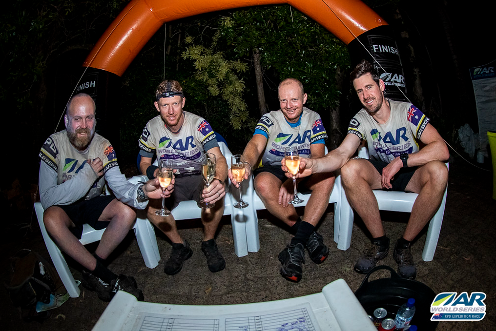
The walk down the mountain was pleasant and we were soon on the beach with the end in literal sight – somewhere around midnight we clocked into the finish, hooray!
P.S.
It was a pretty good effort from the team to race with a sense of quiet urgency, and relaxed enough that we weren’t really stuffed by the end.. It shows that with reasonable navigation and keeping moving (without running or pushing) you can beat the cut offs and reach the end full course ranked – which turns out to be 10th overall! (We were also 1st all male team).
Adam’s team video: https://drive.google.com/file/d/1caySlnw68mMuy_fzhpSFSrmDYBsryFoX/view?usp=sharing
Extras:
Live tracking page: https://live.trackmelive.com.au/xpd2021/
Course roadbook: https://1drv.ms/b/s!AifTFczu36vl63JSQefJHIBS_2FH
Team list: https://1drv.ms/u/s!AifTFczu36vl7AD3Au2GaKR0Da_J
Maps: https://www.dropbox.com/…/AAAV_yf3fPwSFtBLnlPCxVmBa…
Race commentary: https://www.facebook.com/arwsoceania & photos and videos: https://www.facebook.com/geocentricoutdoors